Smart Forest Platform
แพลตฟอร์มเพื่อการจัดการและดูแลป่าอัจฉริยะ

แพลตฟอร์มเพื่อการบริหารจัดการพื้นที่สีเขียว
(Green Area Management)
Smart Forest Solution จากวรุณา ใช้เทคโนโลยีดาวเทียมโดรนมัลติสเปกตรัม และแพลตฟอร์ม บริหารจัดการพื้นที่สีเขียว เพื่อติดตามการเปลี่ยนแปลงทรัพยากรธรรมชาติและ สิ่งแวดล้อม
ทุกวันนี้เทคโนโลยีมีส่วนช่วยให้เราสามารถดูแลสิ่งแวดล้อม และบริหารจัดการทรัพยากรธรรมชาติได้อย่างเป็นระบบ สามารถน้ำข้อมูลดิจิทัลมาใช้ในการวางแผนฟื้นฟูพื้นที่สีเขียว เพื่อติดตามการเปลี่ยนแปลงทรัพยากรธรรมชาติ และสิ่งแวดล้อมบ่งบอกได้อย่างชัดเจน ว่าเครื่องมือเทคโนโลยีด้านการสำรวจพื้นที่ และวิเคราะห์ด้วย AI ที่ถูกนำมาบูรณาการ ร่วมกันอย่างมีประสิทธิภาพนั้นมีอิทธิพล และส่งผลต่อการเปลี่ยนแปลงของพื้นที่สีเขียวของไทย สามารถนำไปพัฒนา และเอื้อประโยชน์ในการวางแผนการทำงานของภาคเอกชน และการมีส่วนร่วมของชุมชนได้เป็นอย่างดี
การประยุกต์ใช้เทคโนโลยีกับแพลตฟอร์ม Smart Forest
Varuna ได้นำเทคโนโลยีภาพถ่ายทางอากาศไปใช้ในการติดตาม การเปลี่ยนแปลงบนพื้นที่สีเขียวสามารถคำนวณคาร์บอนเครดิต รูปแบบใหม่บนพื้นที่ขนาดใหญ่ (Large Scale Carbon credit Solution) โดยการบูรณาการเทคโนโลยีภาพถ่ายดาวเทียม (Satellite) ภาพถ่าย โดรนสำรวจ เเละข้อมูลภาคพื้นดิน หรือโดรนมัลติสเปกตรัม (Multispectral Drone) เพื่อใช้ในการประมวลผลข้อมูลเชิงพื้นที่ ด้วยเทคโนโลยีปัญญาประดิษฐ์ (AI) ผ่านแพลตฟอร์ม เเละวางแผนติดตามการเปลี่ยนแปลงของพื้นที่สีเขียวเพื่อสร้างความยั่งยืนให้แก่พื้นที่ต่อไป

การติดตามการเปลี่ยนแปลงของพื้นที่สีเขียวขนาดใหญ่
(Green Area Monitoring)
การตรวจจับพื้นที่ที่มีโอกาสเกิดไฟไหม้ป่าหรือพื้นที่เผาไหม้
(Wildfire Hotspot Detection and Notification)
การป้องกันการบุกรุกพื้นที่สีเขียว
(Prevention of Deforestation)
การจัดการชุมชนและหมู่บ้านเพื่อส่งเสริมการดูแลพื้นที่สีเขียว
(Community/Village Management for Forest Protection)
การวางแผนเพื่อเพิ่มพื้นที่สีเขียวด้วยภาพถ่ายทางอากาศ
(Forest Replantation Planning by aerial survey)
การสำรวจพื้นที่สีเขียวเพื่อการส่งเสริมพืชเศรษฐกิจในแต่ละพื้นที่
(Forest Survey for the Development of Economics Plant)
ประโยชน์ของแพลตฟอร์ม Smart Forest
DECENTRALIZED MANAGEMENT
การติดตามตรวจสอบป่าไม้สามารถกระจาย อานาจได้ด้วยความช่วยเหลือจากเจ้าหน้าที่ ท้องถิ่นและชุมชน
REDUCE TIME & COST
ลดการเก็บข้อมูลภาคพื้นดิน (บันทึกและ ติดตามต้นไม้แต่ละต้น) เปิดใช้งานการ ตรวจสอบในระดับใหญ่
PRECISE
Forest monitoring helps scope down and prioritize areas to prevent wildfire & deforestation risks and replantation visit.
USER FRIENDLY DESIGN
ทุกคนสามารถเข้าร่วมกิจกรรมอนุรักษ์ป่าได้ แพลตฟอร์มเปิดให้บริการตลอดเวลา
RELIABLE
ที่ตั้งโครงการป่าไม้และเครดิตคาร์บอนสามารถ ตรวจสอบได้ สร้างความน่าเชื่อถือและความ โปร่งใสให้กับผู้ซื้อ
การนำเทคโนโลยีต่างๆ เข้ามาช่วยวิเคราะห์พื้นที่จะยิ่งทำให้ การวางแผนฟื้นฟูทำได้ตรงจุด และแม่นยำมากยิ่งขึ้น
พร้อมทั้งแสดงผลดาต้าที่สำคัญในการตัดสินใจทางธุรกิจ ด้วยระบบการวิเคราะห์ข้อมูลทางภูมิศาสตร์ (GIS) รองรับข้อมูลขนาดใหญ่และแสดงข้อมูลตามกลุ่มของพื้นที่ สะดวกและแม่นยำครบจบในแพลตฟอร์มเดียว
Welcome to Smart Forest Platform
Smart Forest Platform
Green Area Management
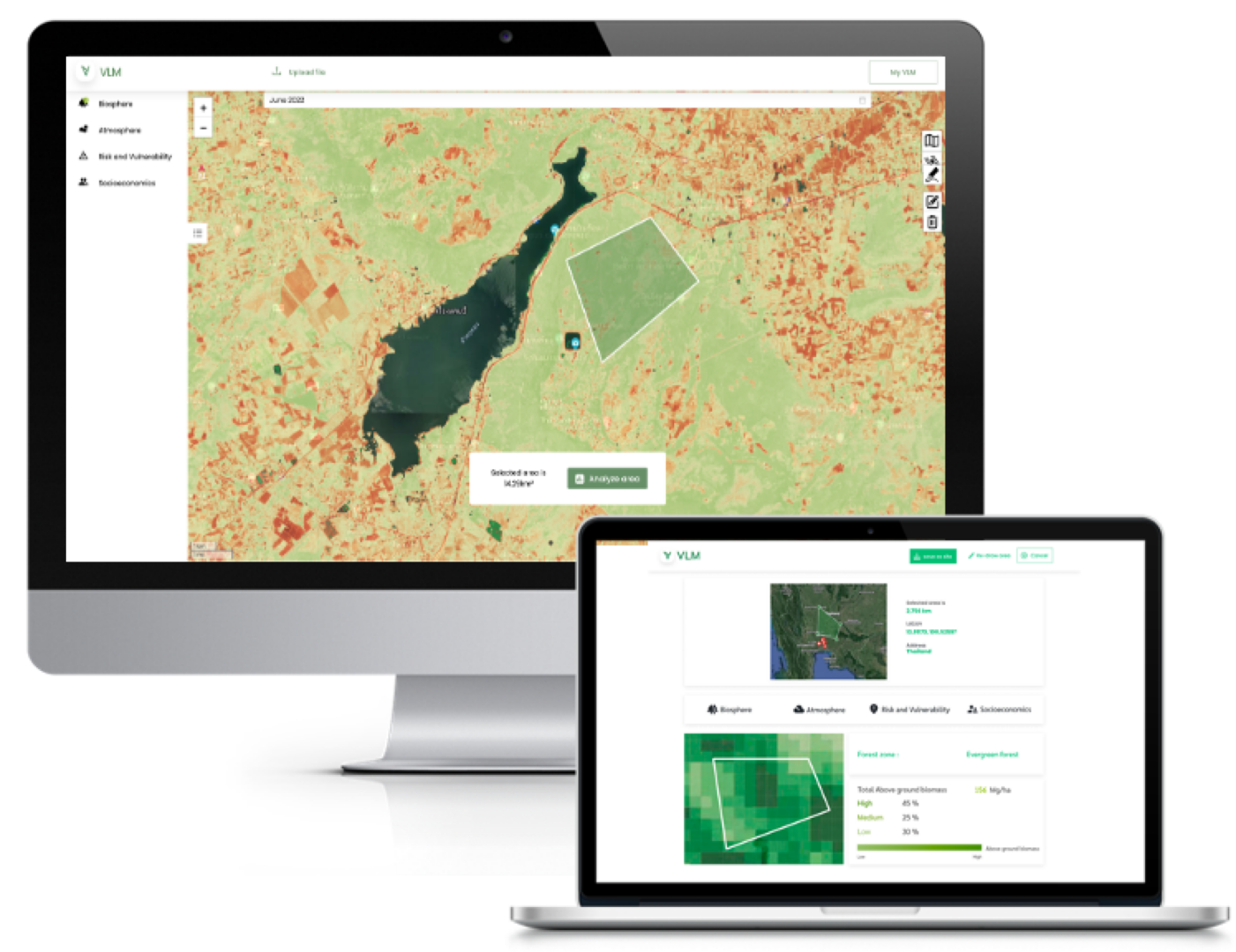
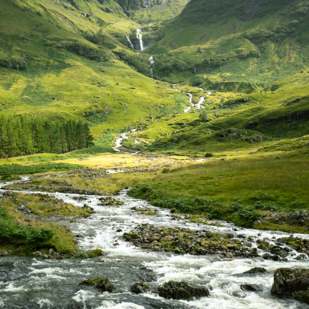
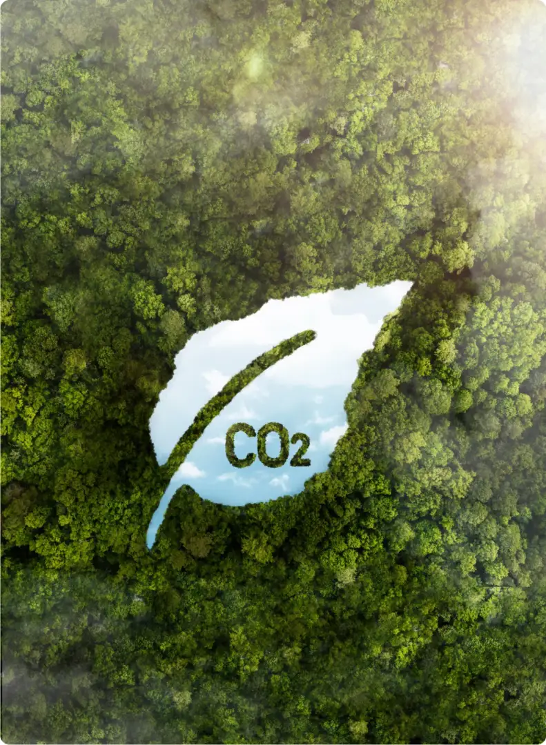
Using multi-spectral drone satellite technology and green space management platform to monitor changes in natural resources and the environment today
Technology helps us to take care of the environment and manage natural resources systematically. Digital data can be used in planning the restoration of green spaces to monitor changes in natural resources and the environment. It clearly indicates that the integrated AI-based land survey and analysis technology tools have an influence and impact on the changes in Thailand's green spaces. They can be used to develop and facilitate private sector work planning and community participation very well.
ประโยชน์ของแพลตฟอร์ม Smart Forest

DECENTRALIZED MANAGEMENT
Forest monitoring can be decentralized with the help of local officers and community.ㅤㅤㅤㅤㅤㅤㅤ

REDUCE TIME & COST
Reduce ground data collection (record and monitor individual tree). Enable large scale monitoring (0.3 ha/day/10 ppl)

PRECISE
Forest monitoring helps scope down and prioritize areas to prevent wildfire & deforestation risks and replantation visit.

USER FRIENDLY DESIGN
Everyone can participate in Forest protection activities. The platform is always on.ㅤㅤㅤㅤㅤㅤ

RELIABLE
Forest project location and carbon credit is traceable, building reliability and transparency for buyers.
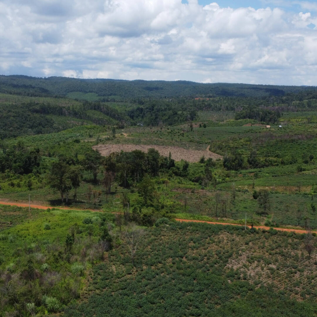
Problems in managing large green spaces
1
It takes a lot of human resources and time to go to the field.
Without technology, it may require a large number of people to go to the field to collect data. Especially if the area is scattered, it also takes a long time to go to the field.
2
Use technology to drive the development of carbon credit projects to reduce time and costs.
Projects that are considered for registration as voluntary greenhouse gas reduction projects according to national or international standards have complex reforestation procedures and require specialized knowledge in various areas.
3
Support community participation in sustainable project development
Obtaining carbon credits requires costs for field surveys, project development documentation, validation, and project registration according to specified standards.
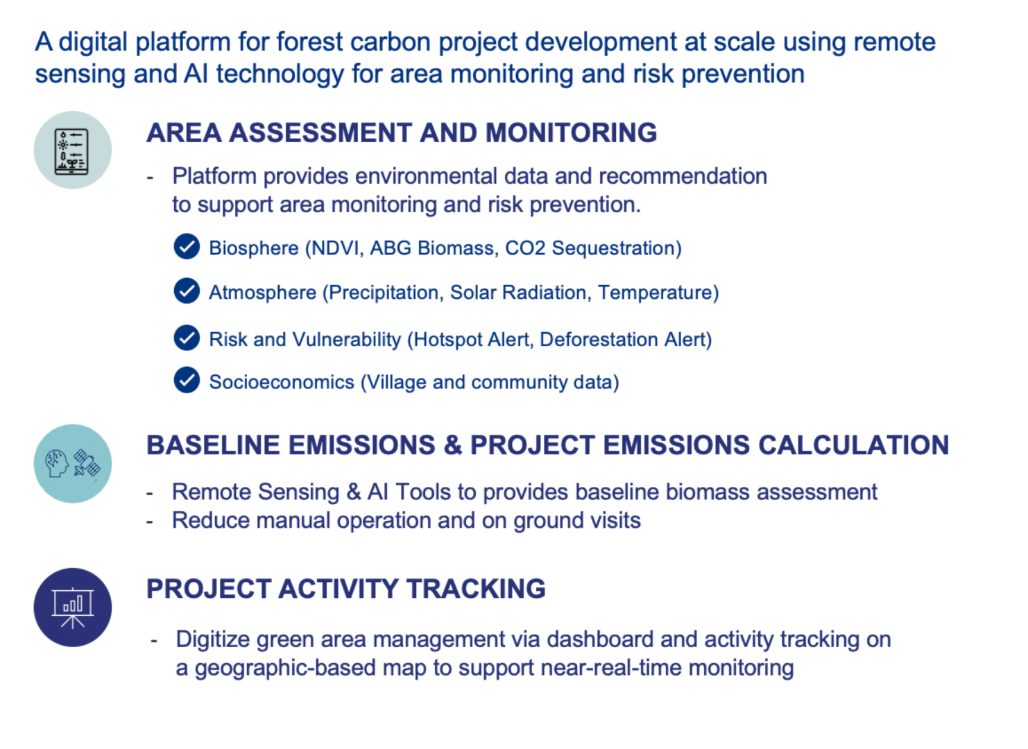
Application of technology to smart forest platform
1
Green Area Monitoring
Help track changes in large green spaces
2
Green Area Management
Help plan and manage green spaces
3
Large Scale Carbon credit Solution
A new solution for monitoring and calculating carbon credits on a large scale
4
Wildfire Hotspot Detection
Helps detect areas prone to forest fires or burned areas.

